|
|
|
MAPS |
 |
Old Maps of
Longmeadow
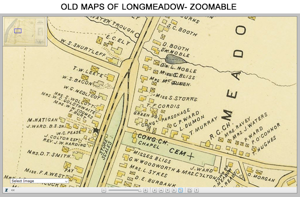
This website feature provides a high resolution look at old maps of
Longmeadow including the 1795, 1831, 1870, 1894,
1912 and 1920 maps. This Zoomable map
utility allows as user to view the fine street
details including names, street addresses,
building shapes and locations, etc.
Here is a
direct link to this new map too.
This tool is best viewed on a desktop computer
or tablet. |
 click image to view interactive map
|
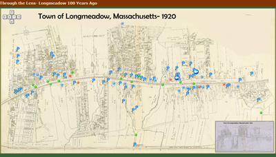
Through the Lens- Longmeadow 100 Years
Ago
Visit Longmeadow as it was being developed into
a suburb of Springfield in the early 20th
century. Using the large number of photos taken
by Paesiello Emerson from 1900 - 1920 and
additional photos that are in our collection + a
1920 map of Longmeadow, an "Interactive
Tour of Longmeadow" was developed by Jim
Moran.
|
|
|
|
|
|
